
This slope overlooks the town of Hveragerði and was where Viking Race 1996 was flown. The slope is around 120 meter in height and faces East South East. Parking is about 1 minute from the slope. For competition we might choose not to start flights if the wind is below 4 m/s depending on how crossed it is.
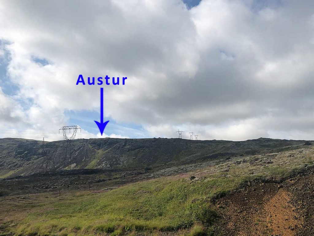
Here we look out over the town of Hveragerði from the slope, the picture above is taken from the road you see, on the left edge of the picture.

Landing area.
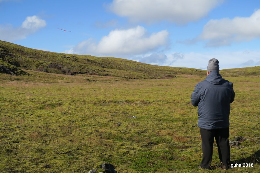
Flying on the slope.
Directions
You drive out of Reykjavik on highway 1 to Hveragerði and you turn off the road to your right when you reach these coordinates 64.0128810°, -021.2567048° or 64°00’46.3716″, -021°15’24.1373″.
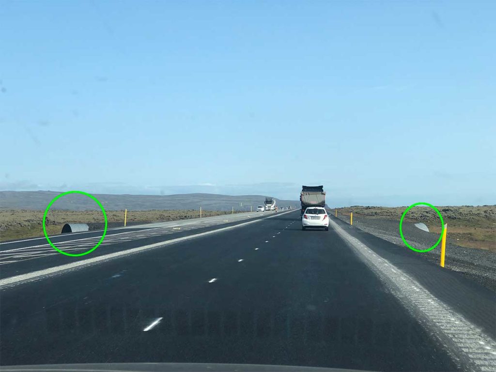
About 1 km before you need to exit highway 1 you drive over a big pipe that is used for traffic crossing under the road.
After turning off highway 1 you drive down the gravel road until you get to an T intersection, make a left turn there and keep driving until you see the slope edge.
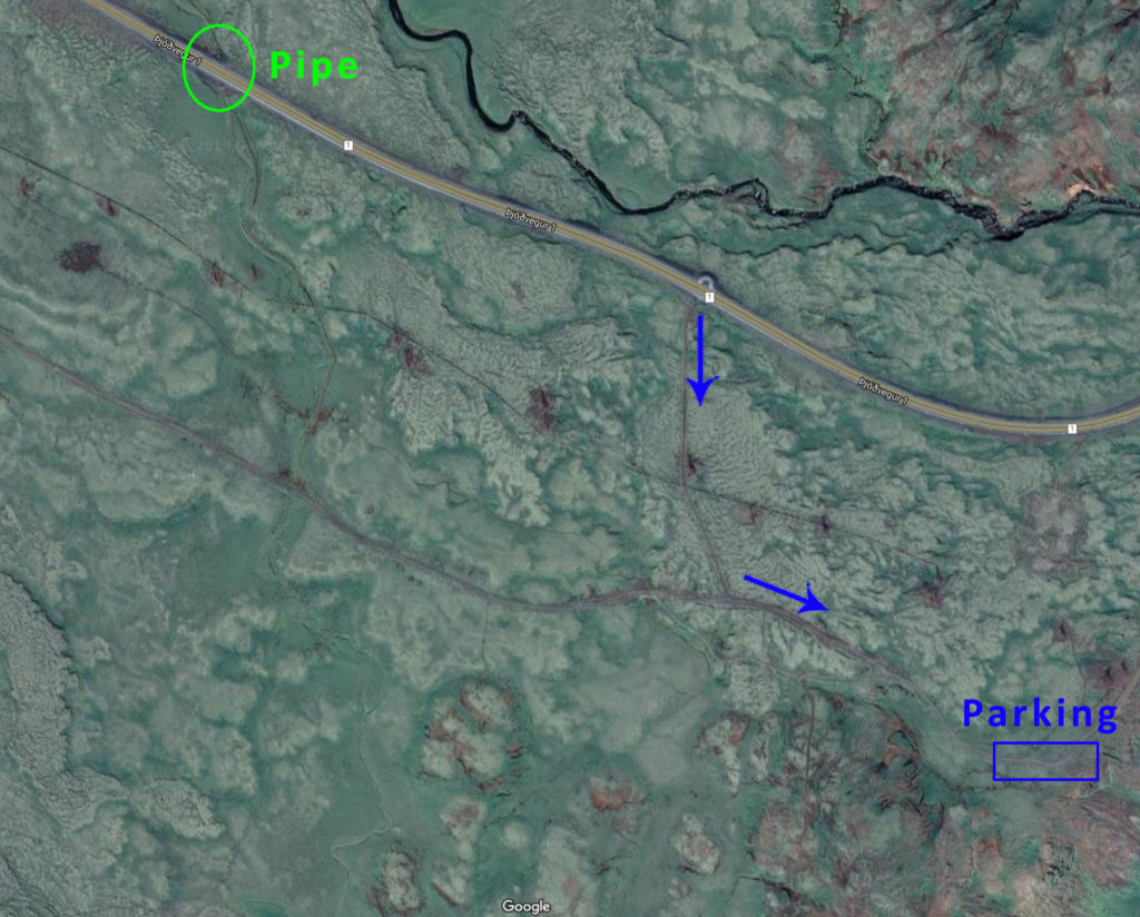
Please keep your car on the gravel road, park on the sides and keep the road clear. Although the traffic isn’t heavy it is still used by other hobbyists from time to time.

When leaving the slope we recommend you take a right turn when you reach highway 1 again and drive about 5 minutes down to the roundabout outside Hveragerði and return to Reykjavik from there.
There are also restaurants in Hveragerði (5 min.), Selfoss (15 min.) and Þorlákshöfn (15 min.).